Chapter 5--
Forms of Condensation and Precipitation
VIDEOS CHAPTER 5
TEST 2 MARCH 11TH --- on chapters 3 - 4 and 5 ---- Test 2 is MARCH 11TH
REMEMBER THIS EXAM IS MORE DIFFICULT THAN EXAM 1
CLICK HERE---------->>>>>>>>>>>>>>>https://richhoffmanclass.com/test2review.html REVIEW PAGE FOR EXAM 2 -- CHAPTER 3 - 4 AND 5 ---- <<<<<<<---------------------------CLICK HERE
https://richhoffmanclass.com/test2review.html IT HAS EVERYTHING YOU NEED TO GET AN A ON THE EXAM.
Chapter 5 part 1
Chapter 5 part 2
Condensation occurs when water vapor changes to a liquid. For condensation to take place, the air must be saturated and there must be a surface on which the vapor can condense. In the air above the ground, tiny particles known as (Cloud)condensation nuclei serve as the surfaces on which water vapor can condense. Hydroscopic nuclei, water seeking Salt is an example.
Clouds, visible aggregates of minute droplets of water or tiny
crystals of ice, are one form of condensation. Clouds are classified on the
basis of two criteria: form and height.
Chapter
5 power point
Clouds Out My Window ---- https://www.weather.gov/media/owlie/CloudsOutMyWindow.pdf
https://www.weather.gov/jetstream/clouds_intro
https://www.noaa.gov/jetstream/clouds/ten-basic-clouds
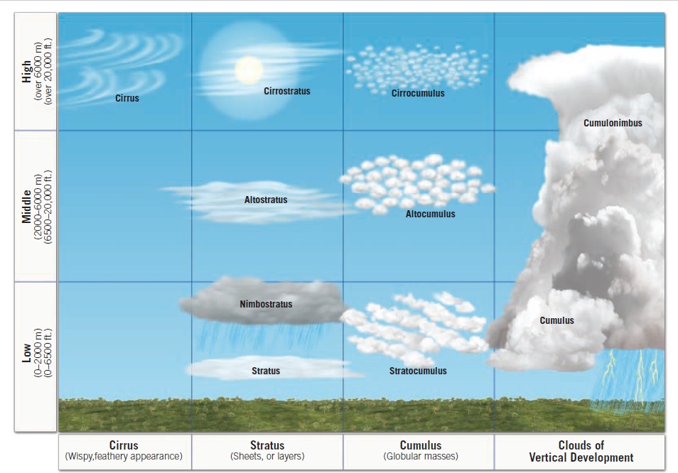
The three basic cloud forms are cirrus (high, white, and thin), cumulus (globular, individual cloud masses), and stratus (sheets or layers).
Cloud heights can be either
High, with bases above 6000 meters (20,000 feet) -- Cirrus
Middle, from 2000 to 6000 meters -- Alto
Low, below 2000 meters (6500 feet) -- Stratus
Based on the two criteria, TEN basic cloud types, including cirrostratus,
altocumulus, and stratocumulus, are recognized.
Nimbo/Nimbus -- Rain Cloud, Dark gray
Clouds of Vertical Development - Cumulus and Cumulonimbus. They
develop into towers or domes.
-- Important go over Page 117 - Page 118 table 5.1 -
REMEMBER THIS EXAM IS MORE DIFFICULT THAN EXAM 1

For precipitation to form, millions of cloud droplets must somehow
coalesce into drops large enough to sustain themselves during their descent.
The two mechanisms that have been proposed to explain this phenomenon are:
Bergeron process, which produces precipitation from cold clouds primarily
in the middle latitudes
1. Supercooled - water in a liquid state below 0C
2. Freezing Nuclei - Supercooled droplets freezing on contact with solid materials.
-10C or below
The warm cloud process most associated with the tropics called the collision-coalescence
process. Large droplets fall more rapidly than smaller droplets,
they are able to sweep up the smaller ons in therepath and grow.
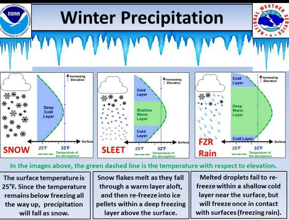
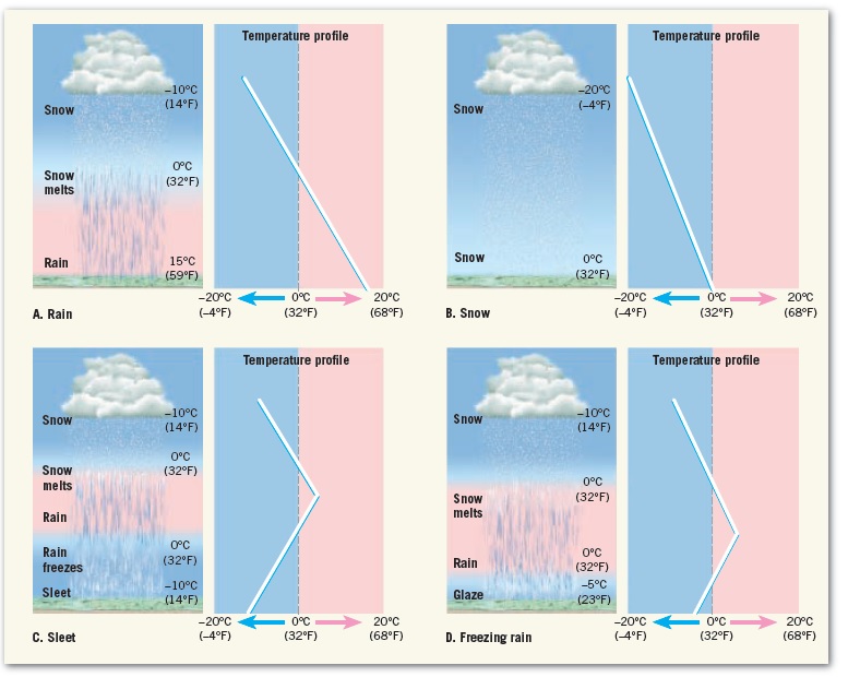
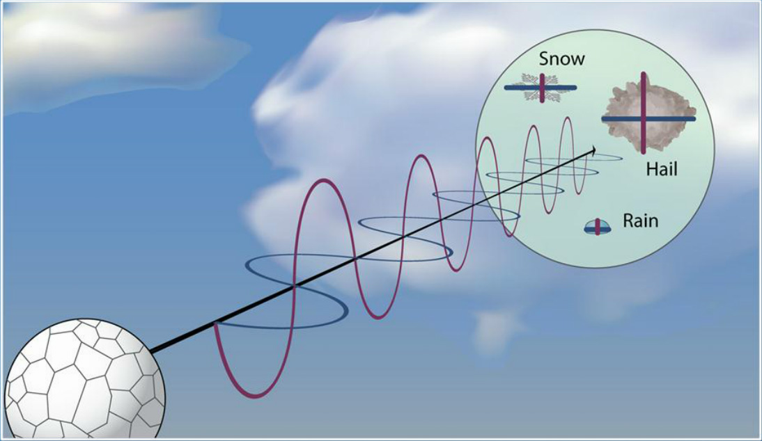
The two most common and familiar forms of precipitation:
Rain (drops of water that fall from a cloud and have a diameter of at least
0.5 millimeter) --Tempertures Above 32F/0C
Snow (precipitation in the form of ice crystals or, more often, aggregates
of ice crystals). Temperatures Below 32F/0C
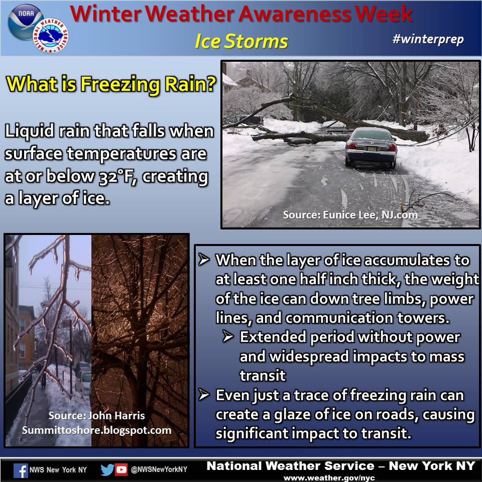
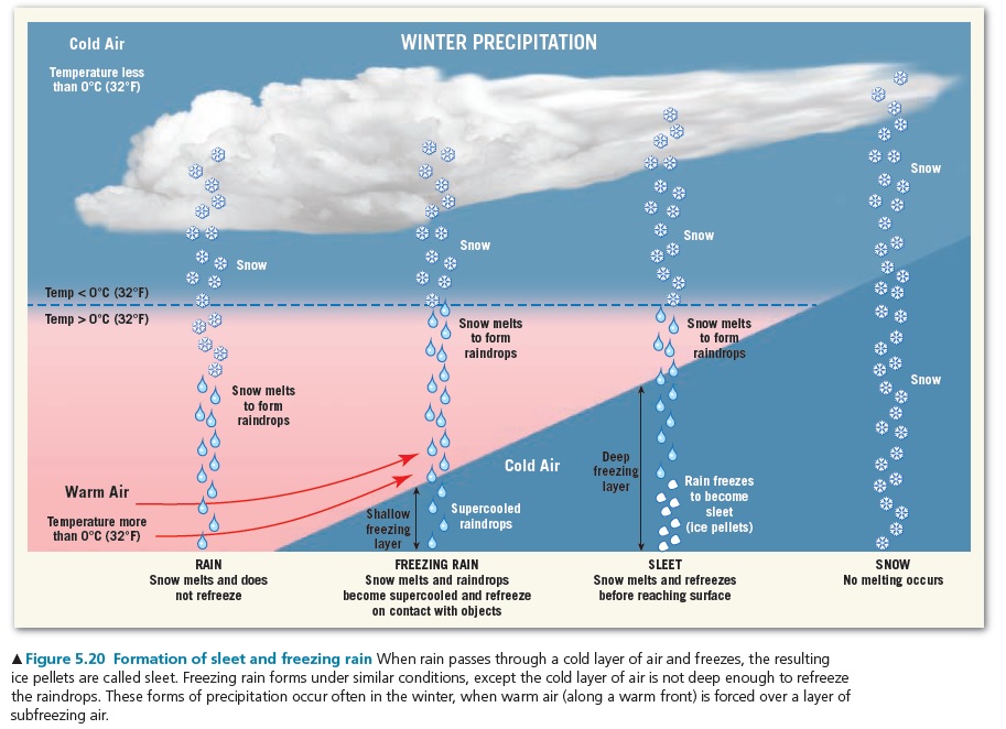
Other forms include sleet (falling small particles of ice that are clear to
translucent), glaze (formed when supercooled raindrops turn to ice on colliding
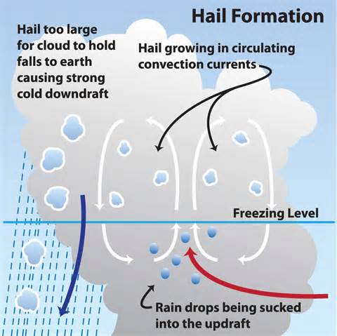
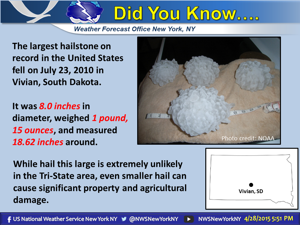
with solid objects), hail (hard, rounded pellets or irregular lumps of ice
produced in large cumulonimbus clouds), and rime (a deposit of ice crystals
formed by the freezing of supercooled fog or cloud droplets on objects whose
surface temperature is below freezing).
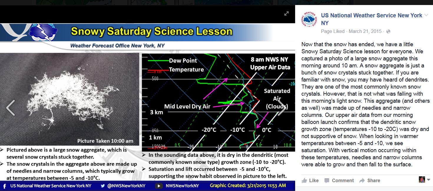
https://www.noaa.gov/jetstream/upperair/skewt_samples
https://www.noaa.gov/sites/default/files/2022-06/ip_sounding.png
https://www.noaa.gov/sites/default/files/2022-06/sn_sounding.png
https://www.noaa.gov/sites/default/files/2022-06/fzra_sounding.png
- PRECIPITATION
LOOK AT PAGE 129-132 - VERY IMPORTANT..
VERY IMPORTANT TOPIC--
TEST 2 MARCH 12TH --- on chapters 3 - 4 and 5 ---- Test 2 is MARCH12TH
REMEMBER THIS EXAM IS MORE DIFFICULT THAN EXAM 1

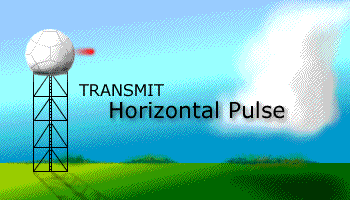
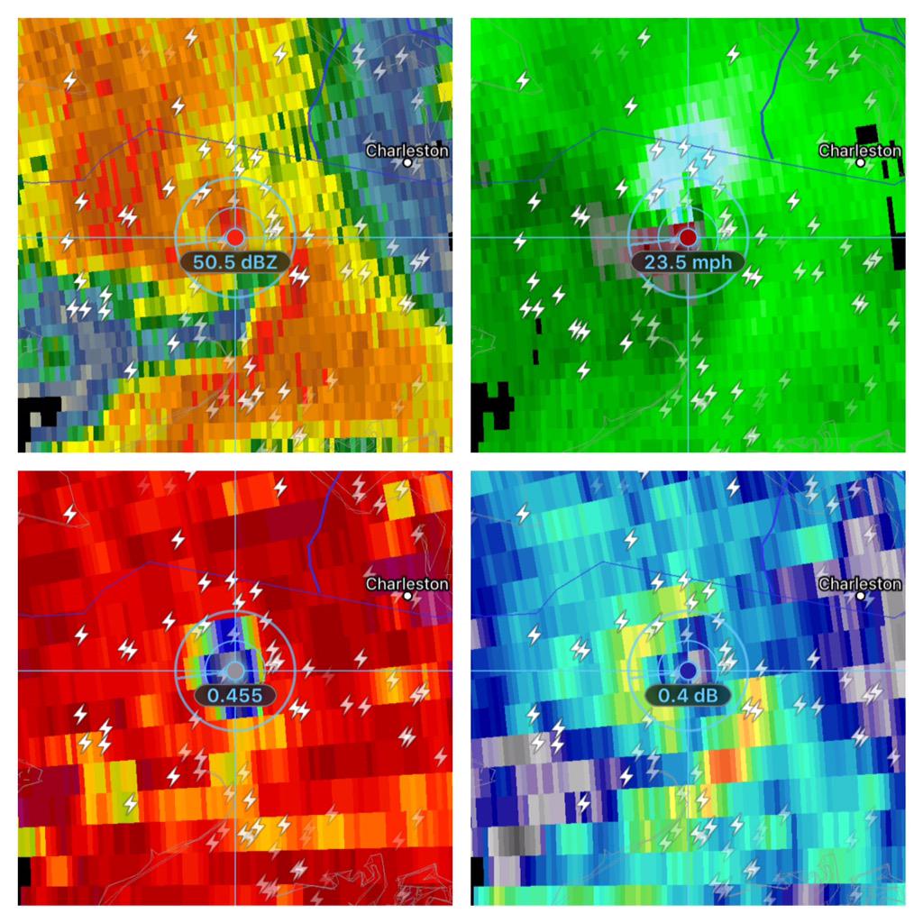
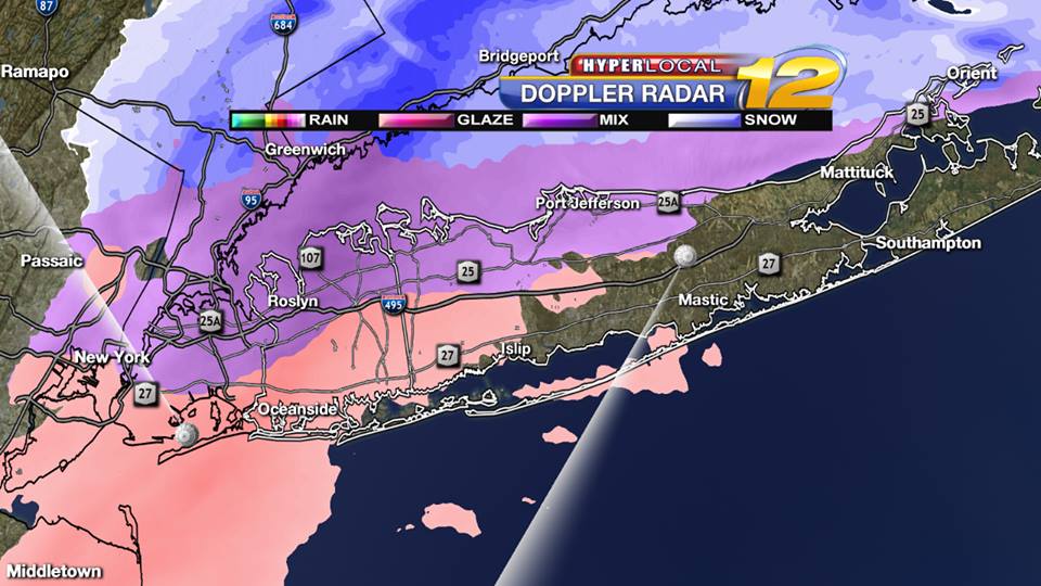
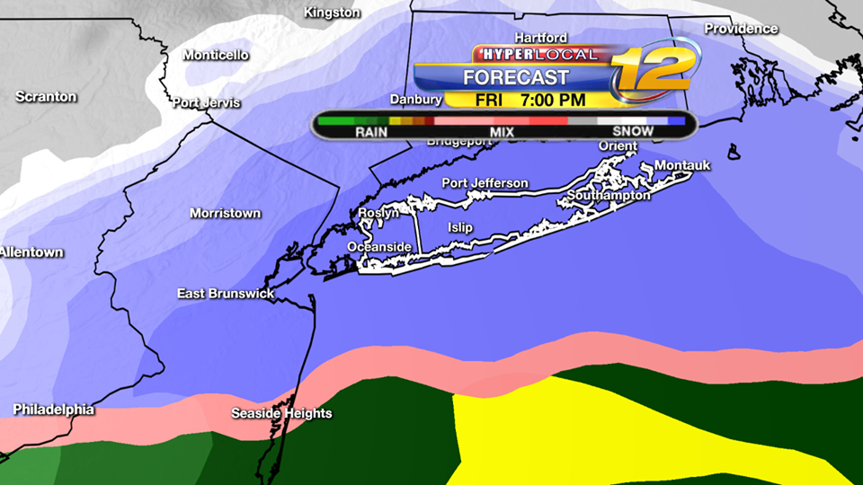
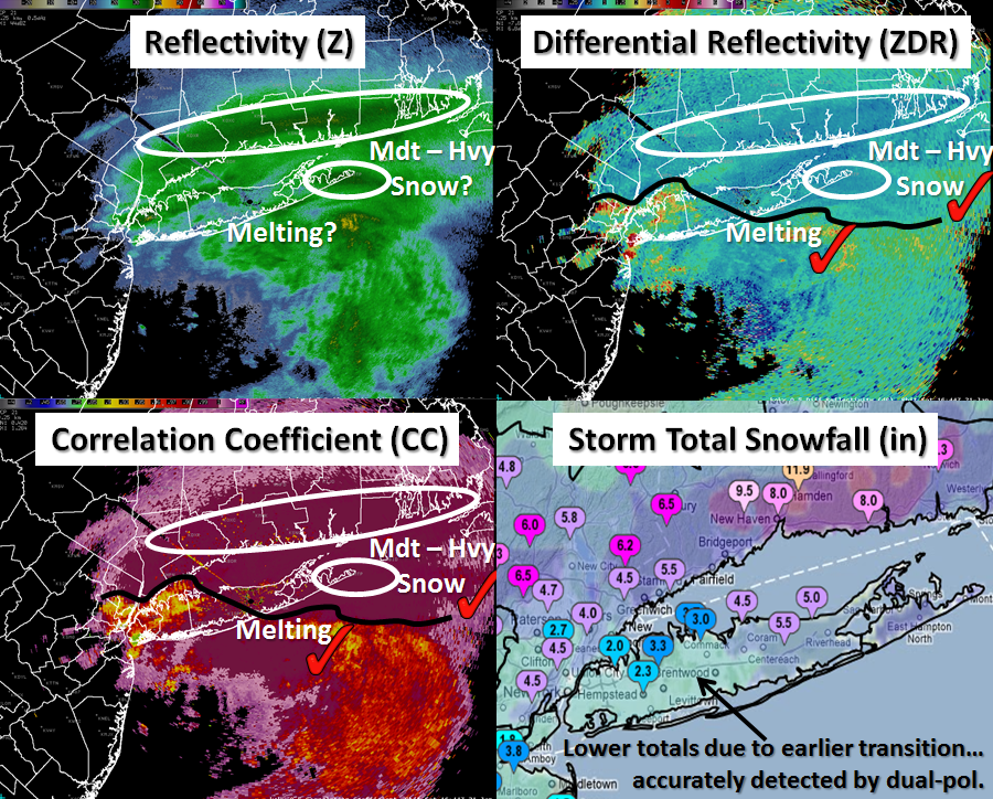
DOPPLER RADAR -

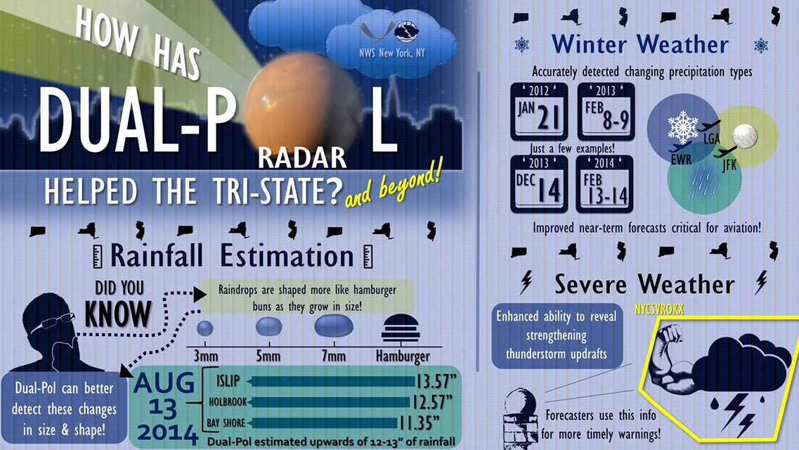
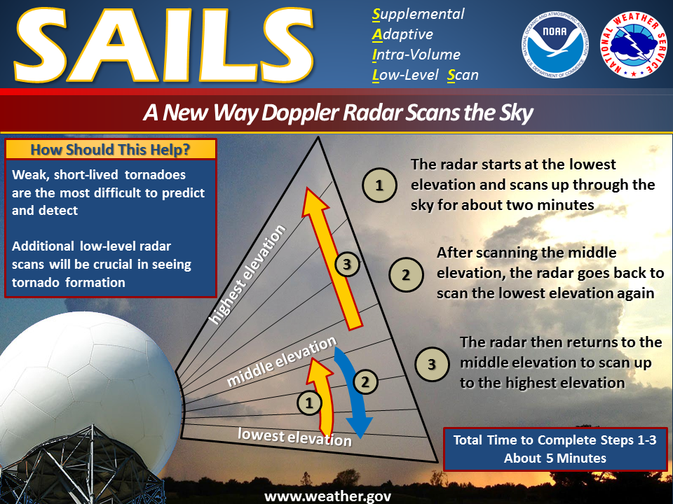
PRECIPITATION
http://www.weather.gov/images/okx/Climate/CentralPark_ASOS.jpg
BELOW ARE EXAMPLES OF HOW DOPPLER RADAR LOOKS
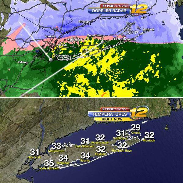
Islip, NY January 21st 2012 3.6 inches of snow
http://www.wunderground.com/history/airport/KISP/2012/1/21/DailyHistory.html?req_city=Islip&req_state=NY&req_statename=&reqdb.zip=11751&reqdb.magic=1&reqdb.wmo=99999
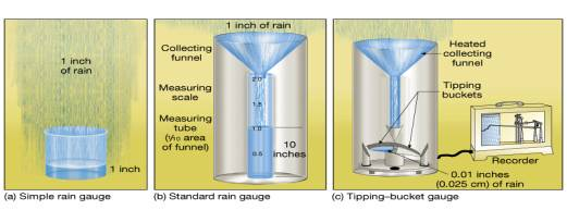
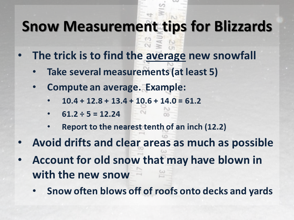
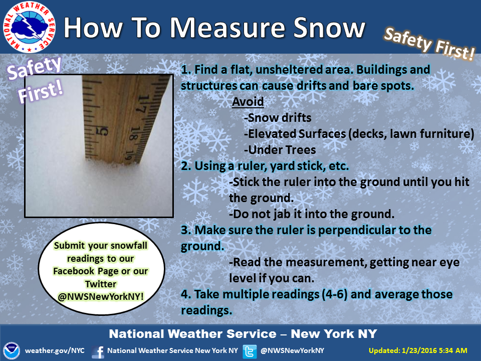
*********Rain, the most common form of precipitation, is probably the easiest to measure. The most common instruments used to measure rain are the standard rain gauge, which is read directly, and the tipping bucket gauge and weighing gauge, both of which record the amount and intensity of rain. The two most common measurements of snow are depth and water equivalent. Although the quantity of water in a given volume of snow is not constant, a general ratio of 10 units of snow to 1 unit of water is often used when exact information is not available. At 32 degrees F, 1 inch of liquid rain would be about 10 inches of snow. At 19 Degrees F, 1 inch of liquid would be about 20 inches of snow.
Intentional weather modification is deliberate human intervention
to influence atmospheric processes that constitute the weather.
Weather modification falls into three categories
(1) the use of energy to forcefully alter the weather
(2) modifying land and water surfaces to change their natural interaction
with the lower atmosphere
(3) triggering, intensifying, or redirecting atmospheric processes. The focus
of intentional weather modification using modern weather technology is on
cloud seeding, fog and cloud dispersal, hail suppression, and frost prevention.
Fog, generally considered an atmospheric hazard, is a cloud
with its base at or very near the ground.
Fogs formed by cooling include radiation fog (from radiation cooling of the
ground and adjacent air),
Advection fog (when warm and moist air is blown over a cold surface)
Upslope fog (created when relatively humid air moves up a slope and cools
adiabatically).
Those formed by evaporation are steam fog (when rising water vapor over warm
water condenses in cool air) and frontal fog (when warm air that is lifted
over colder air generates precipitation that evaporates as it descends and
saturates the air near the surface).
Dew is the condensation of water vapor on objects that have radiated sufficient heat to lower their temperature below the dew point of the surrounding air. White frost (hoar frost) forms when the dew point of the air is below freezing.
TEST 2 MARCH 11TH --- on chapters 3 - 4 and 5 ---- Test 2 is MARCH 11TH
REMEMBER THIS EXAM IS MORE DIFFICULT THAN EXAM 1